Note
This post is about subways, and includes some extremely large images that may display badly. I apologize for that.
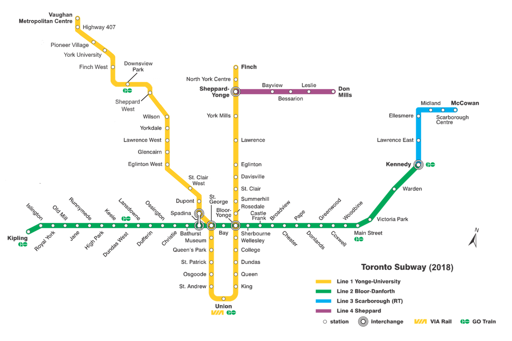
I've lived most of my life in Toronto, but travelling has made me realize our metro isn't as extensive or as great as I thought it was as a kid. Arguably at the time it was both of those things, but it simply hasn't kept up ... It's not a terrible system, but it's barely progressed since I graduated university 30 years ago. Here it is, in all its current glory:
My latest trip took me (back) to Tokyo. This is the subway map they give out at most stations:
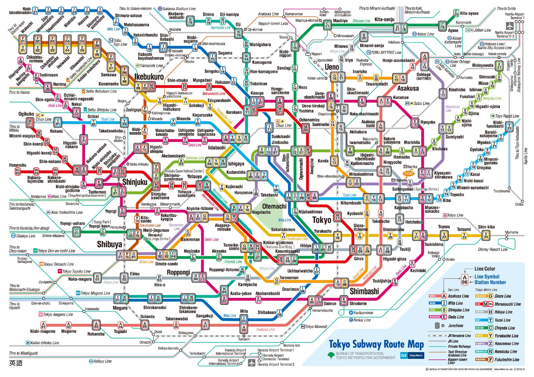
Trying to find your way around is ... challenging. But there's an app for that. Although the app chooses to entirely ignore the JR Yamanote Line (the grey dashed line on the map above that does a loop around the centre of the city) - which is unconscionable. It's an incredibly useful line - but they run into the problem of multiple lines run by different vendors - Toronto's system is run entirely by one organization, so your fare applies across all trains, buses, and streetcars.
But the Tokyo subway map is child's play compared to Seoul's map:
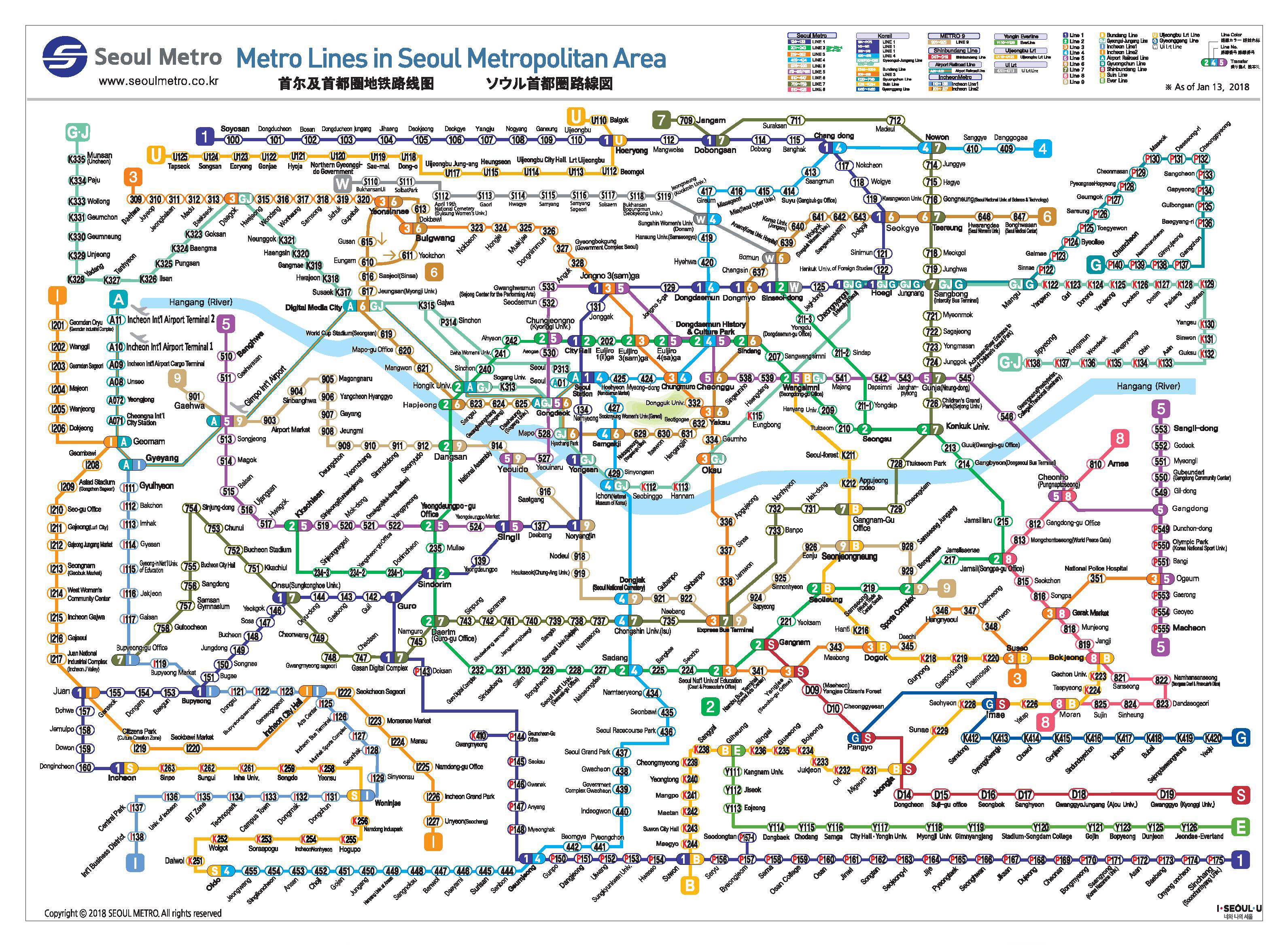
They have an app for that too ... in fact they have several: I don't know if this is the official one or if there is an official one: it's fairly good.
But the truth is, Tokyo is just messing with you with that subway map: Metropolitan Tokyo extends WAY beyond the subway map, as does its commuter train network:
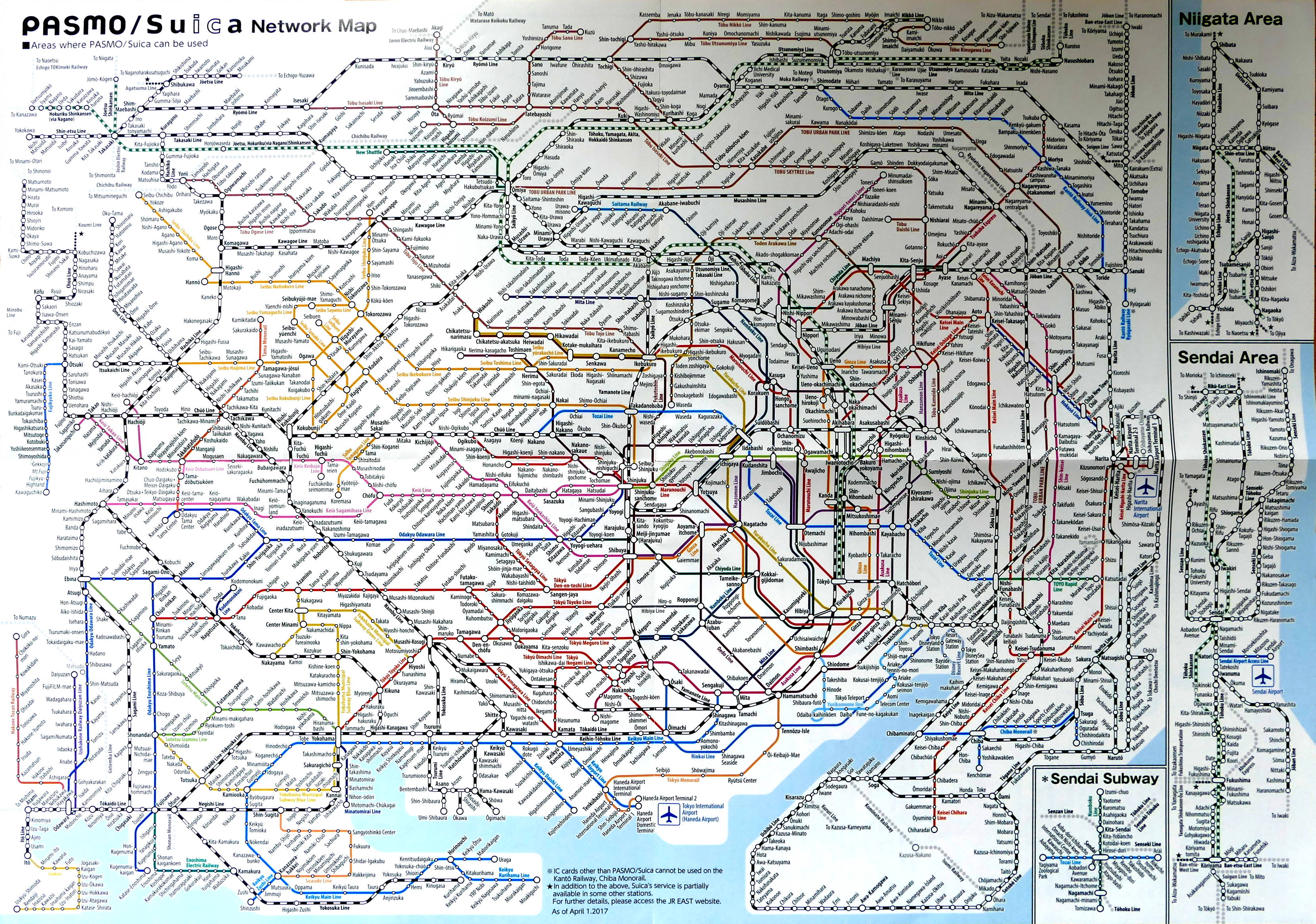
[I apologize for the quality of the image: I couldn't find a publicly licensed image of this, so I took a photo myself and didn't spend the time to clean it up properly.]
I made use of both the Mitaka and Aoto stations: see if you can find either one ... Both of those stations were reached by trains that started their runs well within the borders of the previous map, but then just cruised off the old map like the lines they were on didn't end at the edge of the map ... It had quite a "there be dragons here" feel to it. Not only was it the same train, but the same Suica and Pasmo pay-as-you-go cards worked fine, and the fees were quite reasonable (~$4 out to Mitaka, ~$12 passing through Aoto, but only because I was coming from Narita airport).
Another entire blog post could be written (almost certainly has been by someone else, won't be me) about the relationship between metro maps and actual geography. I think the Seoul map in particular has a bad case of wrapping things back on themselves to fit them in where a straight line would have made the map much larger.
I know this isn't a terribly useful post and it doesn't have much of a point ... but I'm fascinated by subways and subway maps.