photo: The Ochre Hills trail in Terra Nova National Park
I had breakfast this morning with Ken and Kathy, some friends who live here: the visit started with a walk to the pond at the back of their property to feed the ducks. They provided a really lovely breakfast, a bunch of advice on the island, and stocked me up with partridgeberry muffins - which it turns out I really like. And then I was on the road, headed for Terra Nova National Park. As you head out of the Avalon Peninsula, the terrain goes all Scottish Highlands for a kilometre or two - big hills of rock sticking out of terrain that seems to be mostly moss and clumps of scrub pine.
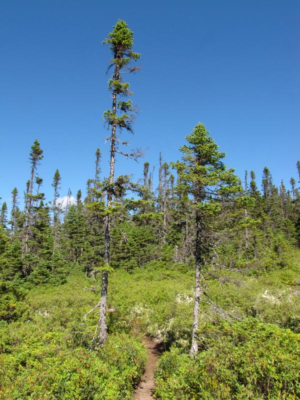
Terra Nova was described by one of my guidebooks as being the guy in a minivan with his family, while Gros Morne was the extreme sports version. I did the Ochre Hills Trail first. This is a lovely bog (remembering that I actually really enjoy bogs), but what was that about a hill? Then there was signage pointing to a lookout, so I followed it. Usually these things are anywhere from 5m to 100m off the trail ... but this just went on and on. And started to climb. Except near the tops of the hills, the large majority of the trail was actually quite soft and spongy. Outside the bog, the trail was lined with deer moss and blueberries (and taller blueberry-like bushes I don't have a name for) everywhere, with a bit of scrub pine mixed in. Lots of blueberries for the picking. And once you're up the hills - the views over bogs, a couple small lakes, and scrub pine was just amazing. At the end of that trail another hiker showed me a trail map because I thought it was a loop trail ... it is, but with this very long same-return trail jutting off to the hills. So I was reminded why I always either carry or photograph a trail map before I start.
It also made me think about the difference between "well-worn" and "well-marked" - "well-worn" is really easy to follow ... until you come to a fork. Or worse, several. That's when you really want "well-marked."
Around 1600 I took the trail road back to the highway, and straight across to the Sandy Pond Trail on the other side. That's a 3km flat loop around a pond: it was nice, but not inspiring. The high point was a bird-spotting: I saw something Ken has helped tentatively identify as a Greater Yellowlegs.
Made the rest of the drive to Gander, which to most people is just a strip of hotels and motels facing the TCH (TransCanada Highway). I got settled into one of those, then tried to go to the #1 rated (by tripadvisor) restaurant in the town, the Bistro on Roe. Which was closed on Sundays. So I went to the place near the hotel, Jungle Jim's. I actually went in and got seated, but the ambiance was terrible (loud music, fake bamboo and palm trees), the menu was unappealing, and the service was slow. So I walked. To the #9 rated restaurant in Gander, Tim Hortons (perhaps you've heard of it?).